What is a Remote Sensing Technician?
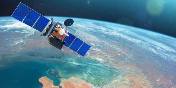
A remote sensing technician specializes in the acquisition, processing, and analysis of data collected through remote sensing technologies. Remote sensing involves the use of various sensors, including satellites, drones, and airborne instruments, to capture information about the Earth's surface and atmosphere from a distance. These technicians play an important role in translating raw data into valuable insights that support scientific research, environmental monitoring, resource management, and decision-making across diverse industries.
Remote sensing technicians may work in fields such as agriculture, environmental science, forestry, urban planning, and disaster response. Their expertise contributes to addressing complex challenges, from monitoring climate change and assessing natural resource usage to aiding in precision agriculture and mitigating the impact of natural disasters.
What does a Remote Sensing Technician do?
Duties and Responsibilities
The duties and responsibilities of a remote sensing technician are diverse, encompassing various tasks related to the collection, analysis, and interpretation of data obtained through remote sensing technologies. Here is an overview of the key responsibilities associated with this role:
- Data Collection: Conduct fieldwork or collaborate with field teams to collect remote sensing data using a variety of technologies, including satellite imagery, aerial photography, LiDAR (Light Detection and Ranging), and drones. Ensure the accurate and timely acquisition of data for specific projects.
- Data Processing and Analysis: Process and analyze remote sensing data using specialized software and tools. This involves applying algorithms, image processing techniques, and geospatial analysis to extract meaningful information from the acquired data. Verify data quality and accuracy.
- Image Interpretation: Interpret satellite imagery and other remote sensing data to identify features, land cover types, and changes over time. Apply expertise in image interpretation to provide insights into environmental conditions, land use patterns, and other relevant factors.
- GIS (Geographic Information System) Integration: Integrate remote sensing data with GIS technology to create detailed maps and spatial analyses. Develop and maintain geospatial databases that contribute to the understanding of geographic patterns and relationships.
- Environmental Monitoring: Apply remote sensing techniques to monitor environmental changes, including deforestation, urbanization, and natural disasters. Contribute to projects aimed at assessing the impact of human activities on ecosystems and supporting conservation efforts.
- Precision Agriculture: Assist in precision agriculture projects by utilizing remote sensing data for crop monitoring, yield prediction, and resource management. Provide insights to farmers and agricultural professionals to optimize farming practices.
- Urban Planning and Infrastructure Monitoring: Support urban planning initiatives by analyzing remote sensing data to assess land use patterns, infrastructure development, and changes in urban landscapes. Contribute to projects aimed at sustainable urban development.
- Research and Development: Stay informed about advancements in remote sensing technology and contribute to research and development initiatives within the field. Explore innovative approaches to enhance data collection, processing, and analysis techniques.
- Collaboration and Communication: Collaborate with interdisciplinary teams, including scientists, researchers, and GIS professionals. Communicate findings and insights effectively to stakeholders, clients, and project teams through reports, presentations, and visualizations.
- Quality Assurance: Ensure the quality and accuracy of remote sensing data by implementing quality control measures and validating results. Address issues related to data artifacts, calibration, and rectification to enhance the reliability of analyses.
- Adherence to Ethical and Legal Standards: Adhere to ethical standards and legal requirements related to remote sensing data use and privacy. Ensure compliance with regulations governing the acquisition and dissemination of remote sensing information.
Types of Remote Sensing Technician
In the field of remote sensing, technicians may specialize in various areas depending on their skills, expertise, and the specific applications of remote sensing technology. Here are some types of remote sensing technicians, each focusing on different aspects of data collection, analysis, and interpretation:
- Satellite Remote Sensing Technician: Specializes in working with data obtained from Earth-observing satellites. Responsibilities include processing and analyzing satellite imagery for applications such as environmental monitoring, agriculture, and land cover mapping.
- LiDAR Technician: Focuses on Light Detection and Ranging (LiDAR) technology, which uses laser light to measure distances and create detailed 3D maps of the Earth's surface. LiDAR technicians process and analyze LiDAR data for applications in forestry, terrain modeling, and urban planning.
- Aerial Imaging Technician: Works with data collected from manned or unmanned aerial vehicles (UAVs or drones). Aerial imaging technicians process high-resolution imagery for tasks such as surveying, infrastructure inspection, and environmental monitoring.
- GIS Remote Sensing Technician: Integrates remote sensing data with Geographic Information System (GIS) technology. Responsibilities include creating spatial databases, mapping, and conducting spatial analyses to derive insights into geographic patterns and relationships.
- Environmental Remote Sensing Technician: Specializes in using remote sensing data to monitor environmental changes, assess the impact of human activities on ecosystems, and contribute to conservation efforts. Tasks may include analyzing vegetation health, identifying habitat changes, and monitoring water quality.
- Precision Agriculture Technician: Focuses on utilizing remote sensing data for precision agriculture applications. This includes monitoring crop health, predicting yields, and optimizing resource management for efficient and sustainable farming practices.
- Remote Sensing Research Technician: Works in research institutions or universities, contributing to studies that advance the field of remote sensing. This technician may be involved in developing new algorithms, testing emerging technologies, and exploring innovative applications for remote sensing.
- Urban Planning Remote Sensing Technician: Applies remote sensing data to urban planning projects, including land use analysis, infrastructure monitoring, and assessing changes in urban landscapes. Works with city planners to support sustainable and efficient urban development.
- Wildlife Monitoring Remote Sensing Technician: Specializes in using remote sensing technology to monitor wildlife habitats, track animal movements, and assess biodiversity. This technician may contribute to conservation projects and research focused on preserving natural ecosystems.
- Disaster Response Remote Sensing Technician: Plays a crucial role in disaster response and recovery efforts by utilizing remote sensing data to assess the impact of natural disasters such as floods, wildfires, and hurricanes. Contributes to emergency planning and risk mitigation.
What is the workplace of a Remote Sensing Technician like?
The workplace of a remote sensing technician is diverse, reflecting the broad applications of remote sensing technologies across various industries. Many remote sensing technicians find employment with government agencies, such as the United States Geological Survey (USGS), National Aeronautics and Space Administration (NASA), and the National Oceanic and Atmospheric Administration (NOAA). In these settings, technicians contribute to environmental monitoring, land management, and scientific research projects. They may be involved in analyzing satellite imagery and other remote sensing data to assess changes in land cover, monitor natural disasters, and support the country's scientific and environmental goals.
Environmental consulting firms also serve as common workplaces for remote sensing technicians. These firms provide expertise to clients on environmental assessments, land use planning, and natural resource management. Remote sensing technicians in this context contribute to projects ranging from habitat monitoring to wetland delineation, applying their skills to support informed decision-making and sustainable practices.
Research institutions and universities are key hubs for remote sensing technicians engaged in cutting-edge scientific studies. These professionals collaborate with researchers on projects related to climate change, ecology, geography, and geology. The academic environment fosters innovation and allows technicians to contribute to advancements in remote sensing technology and its applications.
Moreover, private sector employment is prevalent for remote sensing technicians, especially in companies specializing in geospatial technology and remote sensing services. These organizations may focus on mapping, surveying, and providing solutions for a variety of industries. Technicians working in such settings may find themselves contributing to projects that involve precision farming, urban planning, and infrastructure monitoring.
Fieldwork is another component of a remote sensing technician's workplace, particularly in roles where data collection and validation are essential. Whether working for utility and energy companies conducting power line inspections or conservation organizations monitoring wildlife habitats, technicians may spend time outdoors ensuring the accuracy and reliability of remote sensing data.